MIP — Mohanpura Irrigation Project

// MIP Overview

Mohanpura Major Irrigation Project

The Mohanpura Project lifts water from the Mohanpura reservoir (Newaj River) and delivers it under pressure through 25,000+ km of underground pipelines to irrigate over 1,51,500 Ha of cultivable land across Rajgarh district. It is the pioneering implementation of India's first full-scale PIN (Pressurised Irrigation Network) system from reservoir to farm.

The Mohanpura Project, commissioned in 2018, was the first piped irrigation network + Supervisory Control and Data Acquisition (SCADA) setup in Madhya Pradesh.

Sub-Projects & Command Areas

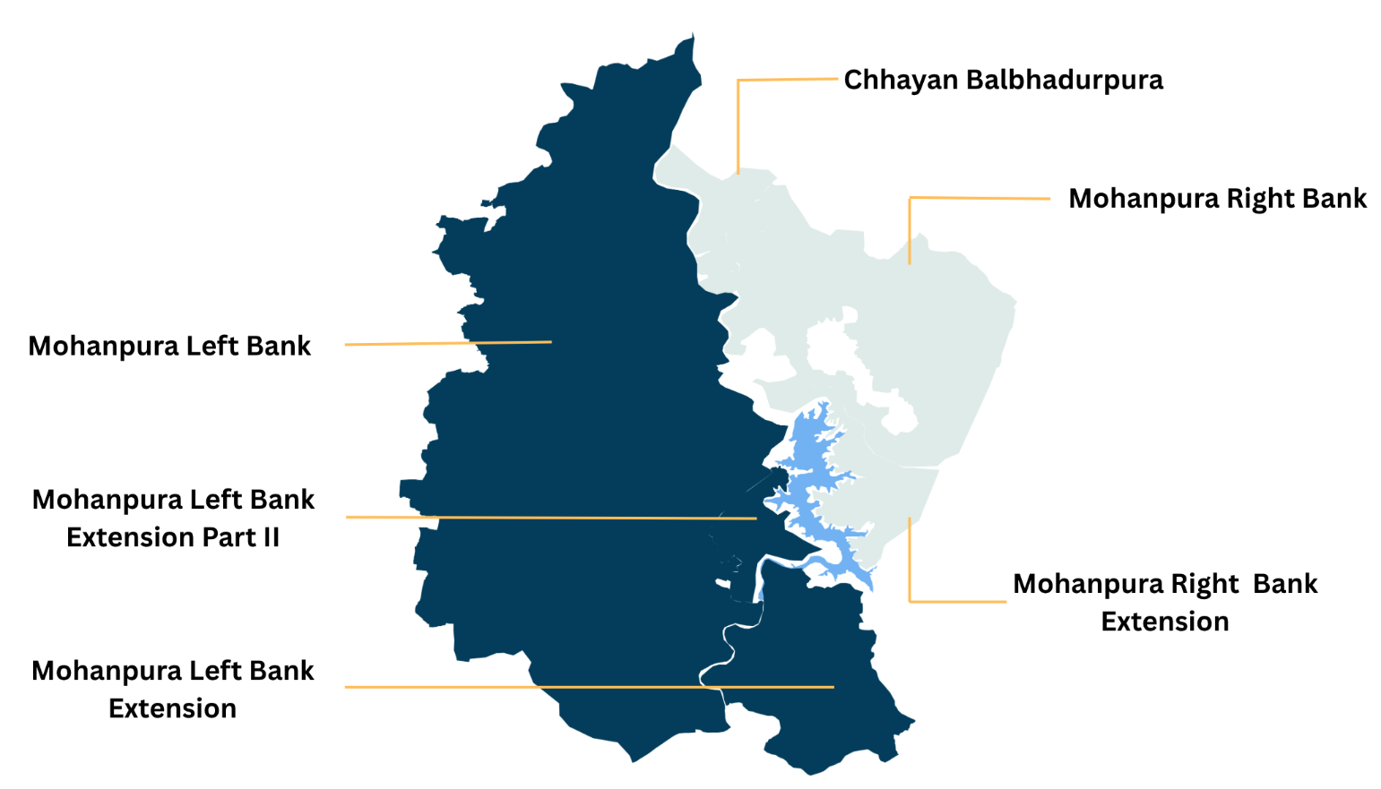
  • Mohanpura Left Bank 1,17,246 Ha
  • Mohanpura Right Bank 34,254 Ha

Water Delivery System

Water is drawn from the Mohanpura reservoir via intake sumps, pressurised through high-capacity pumps, transported through rising main pipes with surge protection, delivered to distribution chambers, and then distributed via an extensive underground pipe network to farm-level outlets (1–1.25 Ha).

Each ~300 Ha unit is remotely managed via sensor-equipped Remote Management Systems, with ~20/30 Ha sub-units controlled by Outlet Management Systems.

MIP Key Statistics

  • Source River Newaj (Chambal basin)
  • Total Storage 616.27 MCM
  • Live Storage 572.96 MCM
  • Pipeline (km) 13053.945 KM
  • Pump houses 17
  • Commissioning 2018
  • Villages served 700+ villages

Water Allocation

  • Irrigation 510.96 MCM
  • Industrial use 5.00 MCM
  • Drinking water 12.60 MCM
  • Environment & ET 52.00 MCM

// Project Schematic

Mohanpura Right Bank Pressurised Irrigation Network

Schematic of the Mohanpura Right Bank pressurised irrigation network: water flows from the Mohanpura reservoir through the approach channel and main pump house, along the rising main to the break pressure tank, then via booster pumping stations to Area A–D distribution zones with farm outlets of 1–1.25 Ha each

Mohanpura Left Bank Pressurised Irrigation Network

Schematic of the Mohanpura Left Bank pressurised irrigation network: water flows from the Mohanpura reservoir through the left-bank pump houses and rising mains into the distribution chambers serving the left-bank command area with farm outlets of 1–1.25 Ha each
Index map of the Mohanpura command areas showing the Mohanpura reservoir, the LBC project command area, the RBC system, the LBC extension, and the proposed Sarangpur and Chhayan extension zones